
A Mixed Bag of Winter Weather Turns to Snow Friday Morning
Winter is back with an icy vengeance on Thursday night and Friday as a cold front brings a mixed bag of rain, sleet, freezing rain, and snow to the Seacoast.
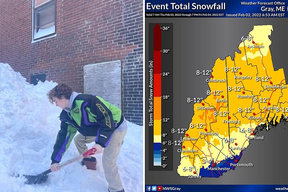
The entire Seacoast is under a Winter Storm Watch from Thursday night into Friday after temperatures go above freezing into the 40s on Thursday, setting the stage for the precipitation starting as rain according to National Weather Service meteorologist Donald Dumont in Gray, Maine.
"A cold front will start to sag through the area and cross through the Seacoast sometime between early evening and midnight. Temperatures will drop below freezing, and after that it's going to change to a wintry mix of sleet and a brief period of freezing rain," Dumont told Seacoast Current.
The precipitation will turn to a heavy snow by daybreak on Friday, making for a slushy commute as snow accumulates on wet roads and the temperature drops. How much snow the Seacoast gets depends on how the precipitation transitions from wet to frozen.

How Much Snow Will The Seacoast Get?
"I would be preparing for at least six inches of snow that will continue for most of the day on Friday before it starts to wind down Friday night," Dumont said.
The early call on snow totals is 4-6 inches for southern Rockingham County including the coastline, and 6-8 inches in Strafford County and inland areas of York County. Essex County can expect 3-4 inches.
Dumont said that unlike Saturday's blizzard, the winds will be light and there will not be any impact from coastal flooding.
Contact reporter Dan Alexander at Dan.Alexander@townsquaremedia.com or via Twitter @DanAlexanderNH
Listener Images from the Blizzard of 2022
Gallery Credit: Dan Alexander
More From 97.5 WOKQ